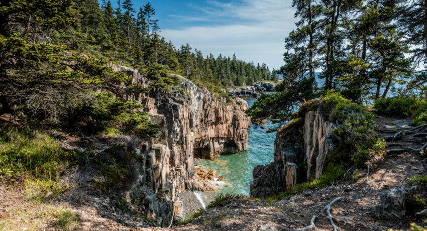
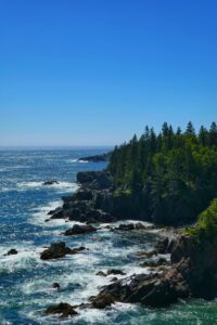
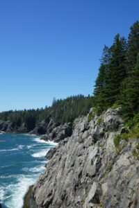
Atop exposed bedrock along Maine’s Bold Coast, you stand at the edge of the world. The wild Atlantic rages before you: Vehement surf colliding with the shore in pulsing battlecries, endlessly pummeling the rocky coastline. Here, you’re given a front-row seat to the eternal contest between the surf and the shore.
Maine’s Bold Coast exudes an adventurous and authentically raw spirit. For this reason, it is no surprise that millions of outdoor enthusiasts flock to it.
For most of us, Acadia National Park is the first place that comes to mind when thinking of Maine’s rugged coastline. The park protects nearly 50,000 acres of coastline and boasts stunning views of spruce and pine forests that abruptly meet the wild Atlantic, but hordes of cars, hikers and bikers make the park feel less wild.
Just two hours north of Acadia lies a public park that lets us experience equally breathtaking views in a setting that maintains a sense of ruggedness. With overgrown trail corridors, bare-boned campsites, and far fewer people, Cutler Coast has often been described as Acadia’s wilder little brother.
Cutler Coast Public Lands offers a taste of wilderness without the overwhelming crowds characteristic of a National Park. Managed by Maine’s Bureau of Parks and Lands, Cutler Coast Public Reserved Lands comprises 12,234 acres and 10 miles of trail that wind through lush woodlands and along steep cliffs that overlook the Bay of Fundy. Cutler cannot compare to the grandeur of its older brother – coming in at a quarter of the size of Acadia and boasting far fewer hiking trails – but it offers visitors solitude and rugged backcountry camping that an easterly national park cannot.
In this travel guide, we’ll highlight the most important things you need to know before visiting Cutler and recommend some of our favorite spots in the park.
Table of Contents
What you need to know
- Cutler Coast is located two hours east of Bar Harbor (Acadia’s gateway town) and 3 hours from Augusta. Accommodation options can be found nearby in the towns of Machias and Lubec. Cobscook State Park is located 30 minutes away and has over 100 campsites with utilities.
- For information on Cutler Coast Public Lands.
- Popular activities in the park include birdwatching, camping, and hiking. In the summer and early fall, visitors may spot whales and porpoises.
- There are no permits or entry fees whatsoever. It is free to park, hike and camp.
- Cutler is a Public Land, not a park. Trails are rugged and there are no facilities. All trash must be packed in and out.
Camping & Backpacking Cutler Coast
- There are five designated campsites located 4-5 miles in from the parking lot, each capable of accommodating 1-6 people.
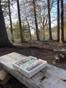
- All food, water and camp stoves must be carried in (campfires are prohibited). These sites have no facilities (aside from very primitive privy toilets located at each site) and are filled on a first-come, first-serve basis.
- Before hiking into the campsites, check the logbook at the trailhead to see if the campsites are full. Campers often (not always) sign into the logbook to notify subsequent campers of camping availability. This is not a sure-fire way of ensuring you’ll find a spot, but it definitely helps.
Our campsite rankings
- Fairy-Head Site #1 and 2 are unbelievable. These sites are right on the coast and offer stunning views from your tent. They are also further down the coastal trail, so if you are looking for a more secluded experience, we’d suggest opting for one of these two sites.
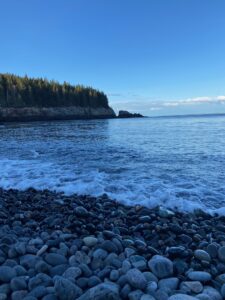
- Long Point Campsite is tucked back the woods off of Long Point Cove. While it does not offer any tent sites right on the coast, it is right next to the majestic Long Point Cove, which is a gorgeous bay along Cutler’s coastline with access to swimming on a pebbly/cobblestone beach.
- Black Point Campsite is closer than the rest but quite small and its proximity to the trailhead means that it tends to be the first one taken.
- Fairy-Head Site 3 ranks last in our campsite rankings. We’ve stayed there before, and it does not offer the same charm or views as any of the other sites. Tucked in a ways from the shore, FH 3 is small and pretty uneven in places. It is also the furthest down the coast.
When to visit
- Cutler Coast Public Reserved Lands are open year-round. Along the popular Coastal Trail, wet or icy conditions are common during the winter and spring. This can make the steep and rocky coastline quite treacherous.
- Summer months attract the largest crowds, but also offer the unique chance to spot whales offshore or to swim in one of the idyllic rocky coves.
- Mosquitos and black flues are the worst in mid-May through early June. Pack a bug-net if you plan on hiking during this time.
- Wild blueberries ripen in late July.
- May, September and October would be the best time to visit Cutler Coast, as the summer crowds have either not yet begun or have faded from their peak.
Best hikes in Cutler Coast Public Lands
1. Coastal Trail to Ocean Overlook
- Difficulty: Easy
- Route Type: Out-and-back
- Duration: 1.5 hours
- Distance: 2.8 miles
If you’re visiting Cutler, hiking the Coastal Trail is a must. While the Inland Trail offers secluded scenery in coastal woodlands, the Coastal Trail hugs the rugged coastline and offers spectacular views over the water.
This 2.8 mile down-&-back hike goes from the Cutler Coast Public Land Trailhead to the Ocean Overlook. The hike only gets coastal once you reach Ocean Overlook, but the view looking southward along the coastline is stunning.
2. Long Point Cove
- Difficulty: Moderate
- Route Type: Out-and-back
- Duration: 4-5 hours
- Distance: 7.8 miles
Long Point Cove is perhaps the most picturesque destination that Cutler Coast has to offer. A break from the jagged rock and dramatic cliffs that drop down to the Atlantic, Long Point Cove has clear, emerald green waters that gently pull and push rocks along its cobblestone beach. The beach has plenty of room and offers the best swimming – in bone-chillingly cold waters– anywhere in Cutler.
From the trailhead, Long Point is a 3.9 mile hike down the coastal trail. The cove is impossible to miss and there is a small staircase that leads down to the beach.
On the way back you have the option to take the Black Point Brook Cutoff on your right shortly after passing the Black Point Campsite. This way, you can take the inland trail back to the trail head if you’d like to experience some of the inland scenery.
3. Fairy Head Loop (Day trip or backpack)
- Difficulty: Hard
- Route Type: Loop
- Duration: 6-7 hours
- Distance: 10.5 miles
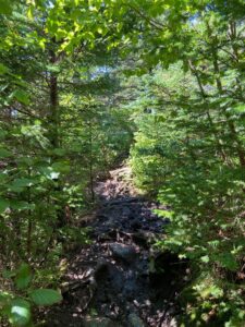
Not for the faint-hearted, the Fairy Head Loop Trail provides the most extensive waterfront experience. The loop is renowned for its breathtaking views of the Bay of Fundy and its rugged inland hiking. The further down the coast you get, the more remote and secluded the trail becomes. If you’re searching for a remote and solitary hike, the bottom section of this loop – including both the Inland and Coastal trail – offers just that. However, you’ll have to work for it.
The loop is 10.35-miles in total and is a very hefty day hike. Thankfully, however, it can easily be turned into a wonderfully-paced overnight trip if you chose to stay at one of the campsites along the coast.
The hike does not have any long stretches of uninterrupted incline, but do not let that fool you. You will clamber up and down constantly – on uneven and slippery rock – and the loop’s total elevation gain is 1,092 feet. With that said, if you have the time and energy, this loop has it all.
The scent of ocean spray, only occasionally interrupted by fragrant pine, will follow you down this scenic stretch of coastline. From the crashing surf to the serenity of forested silence, we cannot recommend this loop enough.

